Notre site web utilise des cookies pour améliorer votre expérience de navigation. Afin d'utiliser ce site de manière optimale, nous vous demandons d'accepter notre utilisation des cookies.

J'accepte l'utilisation des cookies Je n'accepte pas.
retour à l'aperçu

MERIAN, Caspar

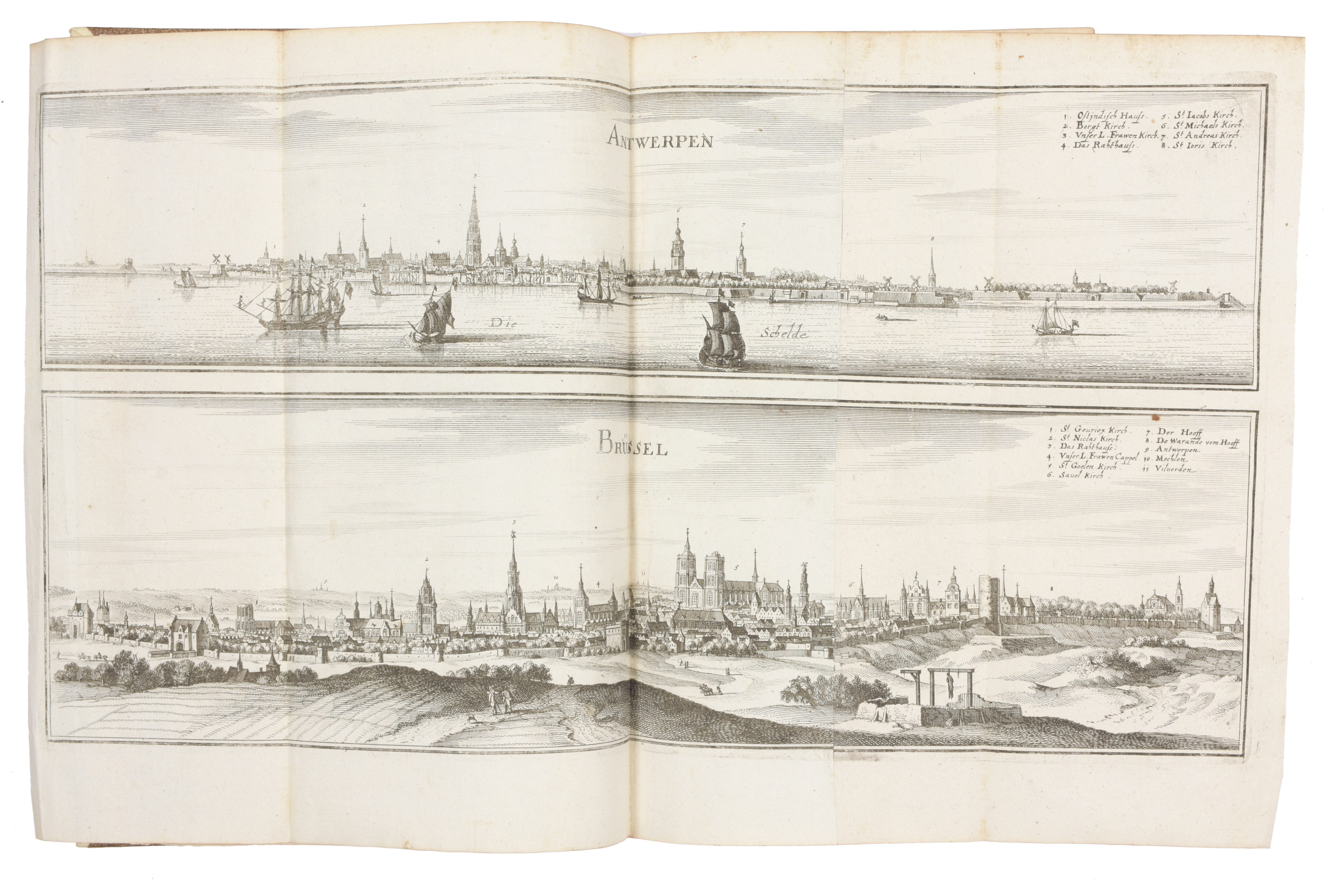
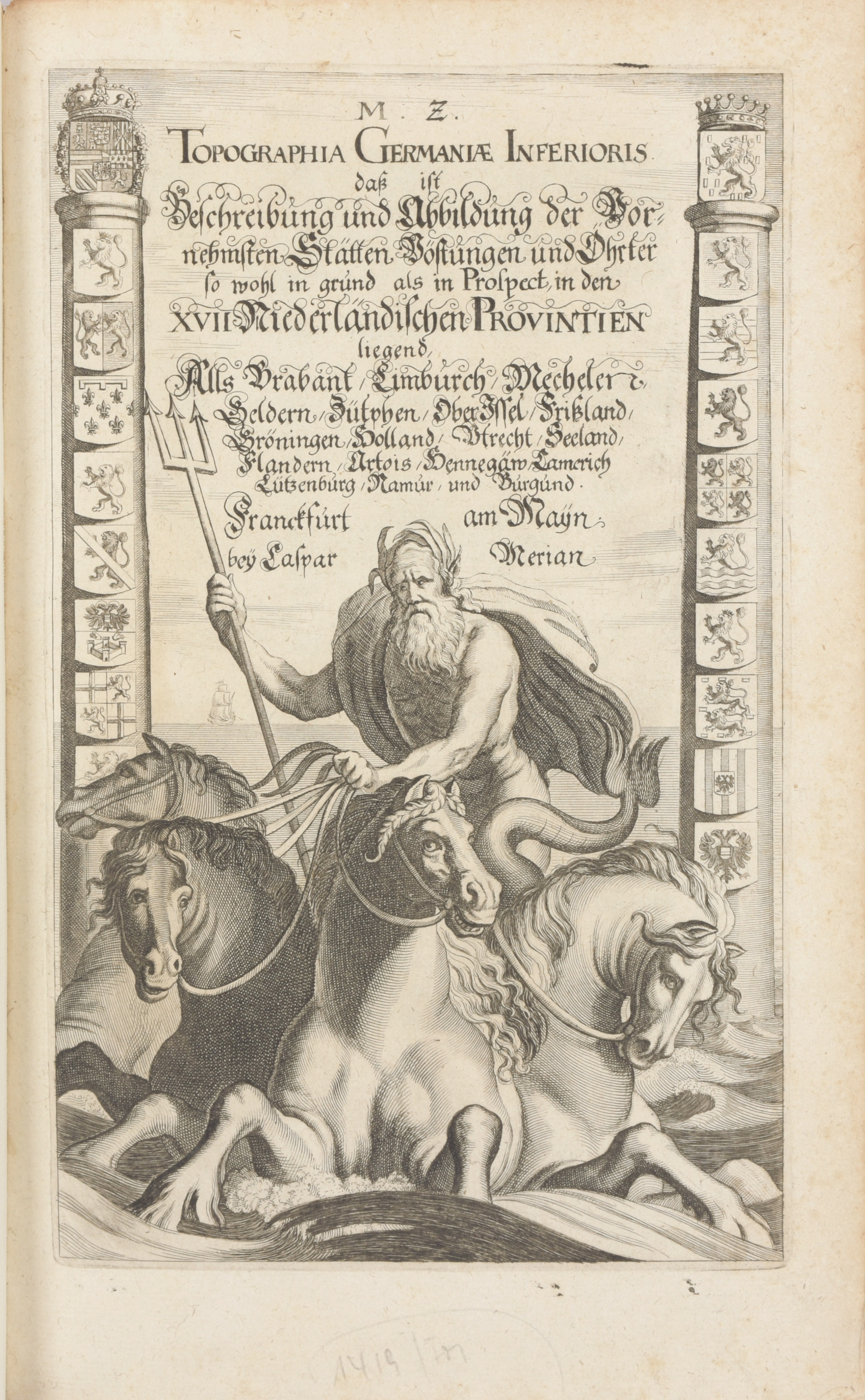
Topographia Germaniae-Inferioris vel Circuli-Burgundici das ist Beschreibung und Abbildung der fürnembsten Örter in den Niderländischen XVII Provincien oder Burgundischen Kränze
Franckfurt
C. Merian
[1680]
€1.800 - €2.400

Folio, 283-[20-1 bl.] pp. Engr. ills : title with Neptune, dolphins and coats-of-arms, 12 double-page maps, 157 views and city maps (Lier cut on margins) on 120 pls, sm. marg. dampst., modern half calf binding in the style of the period on 5 raised bands. Copy in a remarkable binding: rich goldtooled burgundy morocco armorial binding (sl. rubbed, corners sl. rubbed), double gilt-ruled covers with central gilt arms on both boards (sl. stained back cover), richly gilt spine on 6 raised bands (sl. rubbed at top), gilt sides, gilt inside dentelles, marbl. endpapers (stained borders, hole), The leave A2 bound at the end

Later edition (1st 1659) of the splendid description of the Low Countries, with a wealth of information (and maps) on larger and smaller towns, incl. Breda, Haarlem, Rotterdam, Brussels, Leuven, Lier, Mechelen, Brugge, Dendermonde, Geraardsbergen, Kortrijk, Gent, Oostende, Cambrai, Luxemburg, ... Ref. Schuchhard, nr. 69