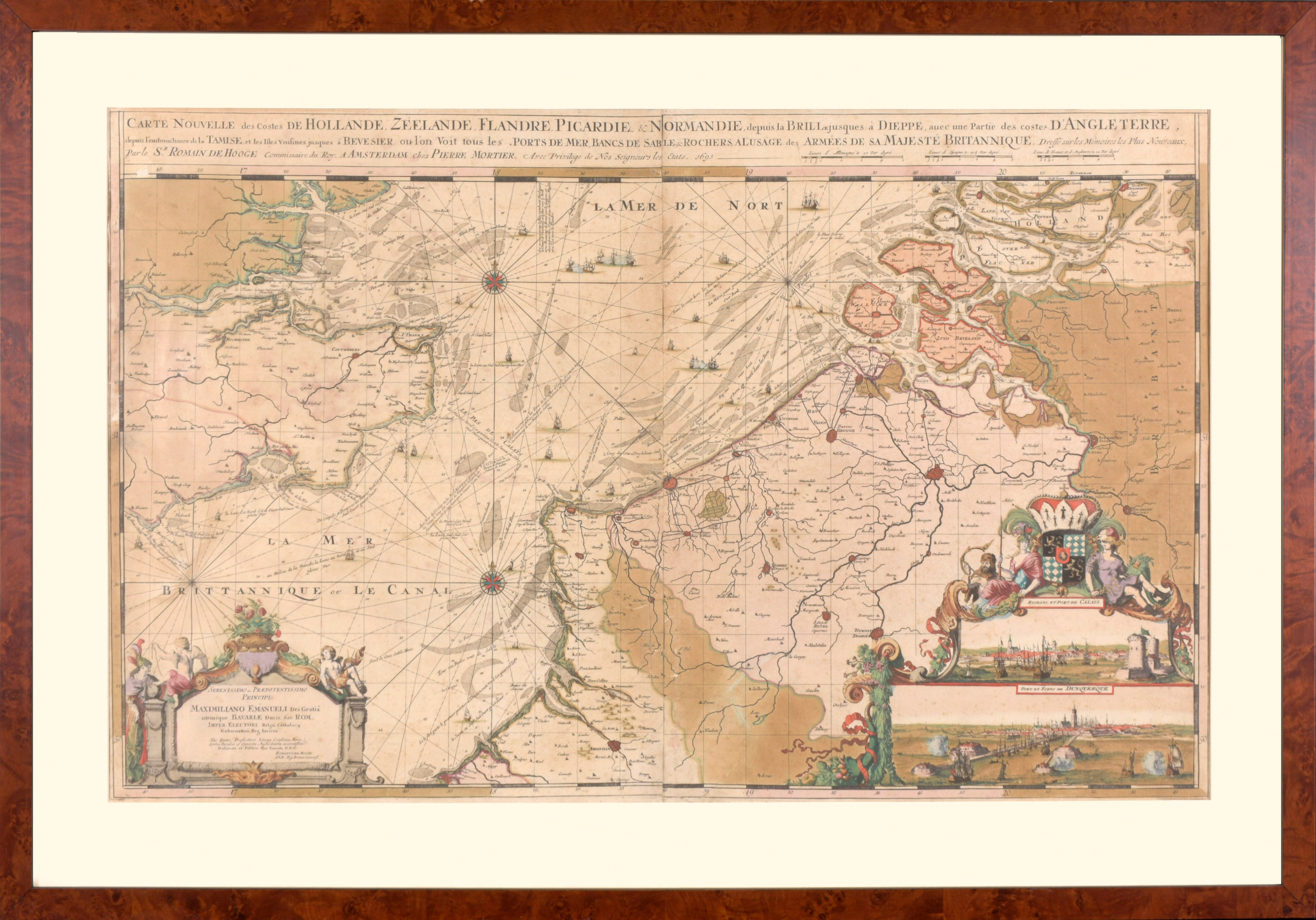
Grande carte maritime (58,5 x 95 cm) en couleur d'époque. Qq petit rest. Avec vues de Dunkerque et Calais dans le cartouche en bas à droite. Amsterdam, Pierre Mortier, ca 1690. Cadre moderne
Nautical chart of British origin designed and etched by Romeyn de Hooghe who was at that time in the service of King William III of England. With 2 inset views of Calais and Dunkirk. From Pierre Mortier's ""Cartes marines à l'usage du Roy de la Grande Bretagne"" that was the most expensive sea-atlas published in 17th-c. Amsterdam. Contrary to Mortier's counterfeited ""Neptune François"", published jointly with H. Jaillot, this work was not based on a printed French prototype, but on ms. charts. The magnificent work was intended as a showpiece rather than as something being used by pilots at sea. Ref. Koeman IV, M. Mor 5/1.