Our website uses cookies to improve your browsing experience. In order to use this website optimally, we ask you to agree to our use of cookies.
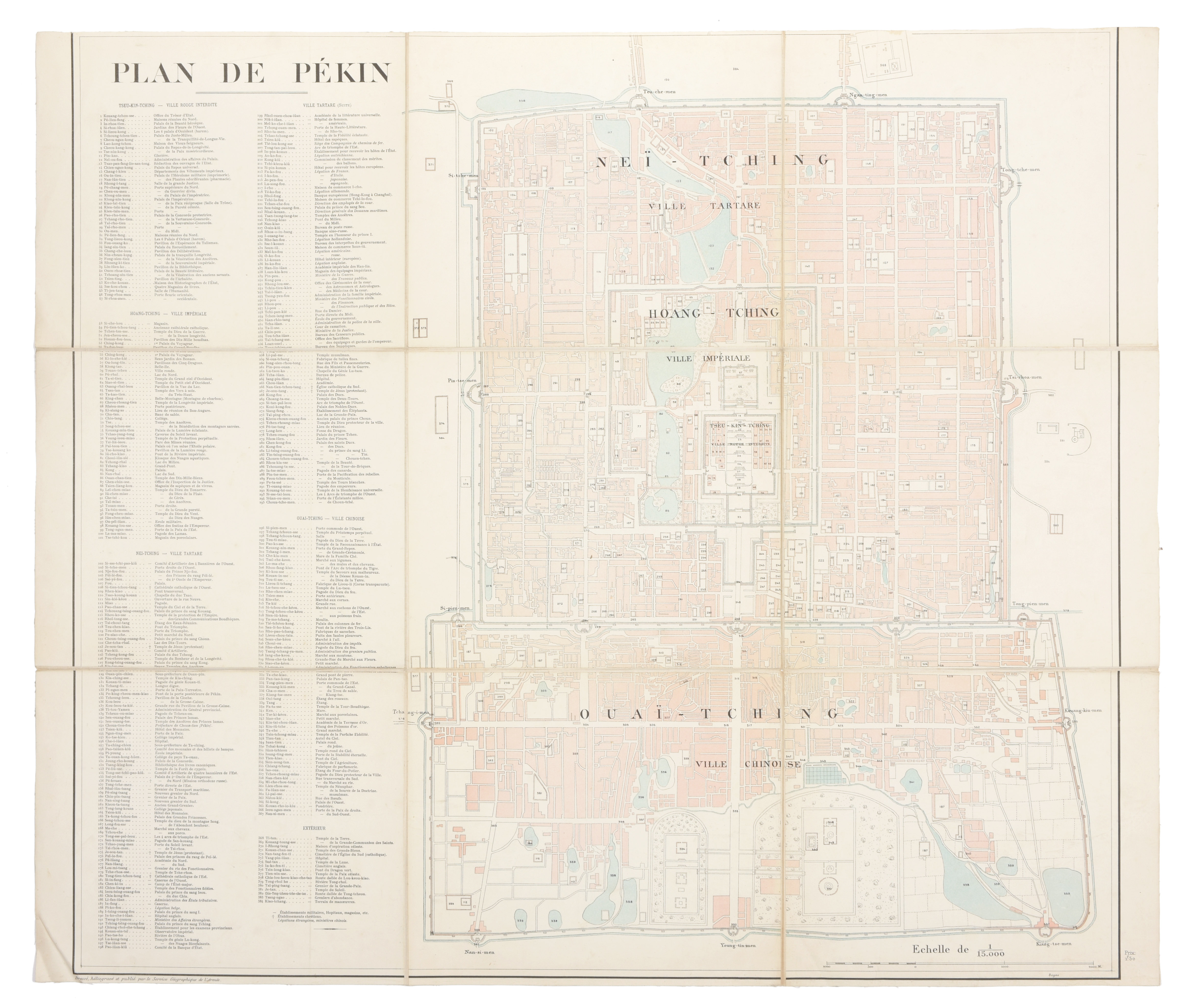
Plan de Pékin, dressé, héliogravé et publié par le Service Géographique de l'Armée

Lithographed folding map (72 x 85 cm) of Beijing published by the French Service Geographique de l'Armée at the beginning of the 20th century. The map includes a massive key with 384 points of interest in both transliterated Chinese and French. Dissected in 9 sections and mounted on linen