Our website uses cookies to improve your browsing experience. In order to use this website optimally, we ask you to agree to our use of cookies.
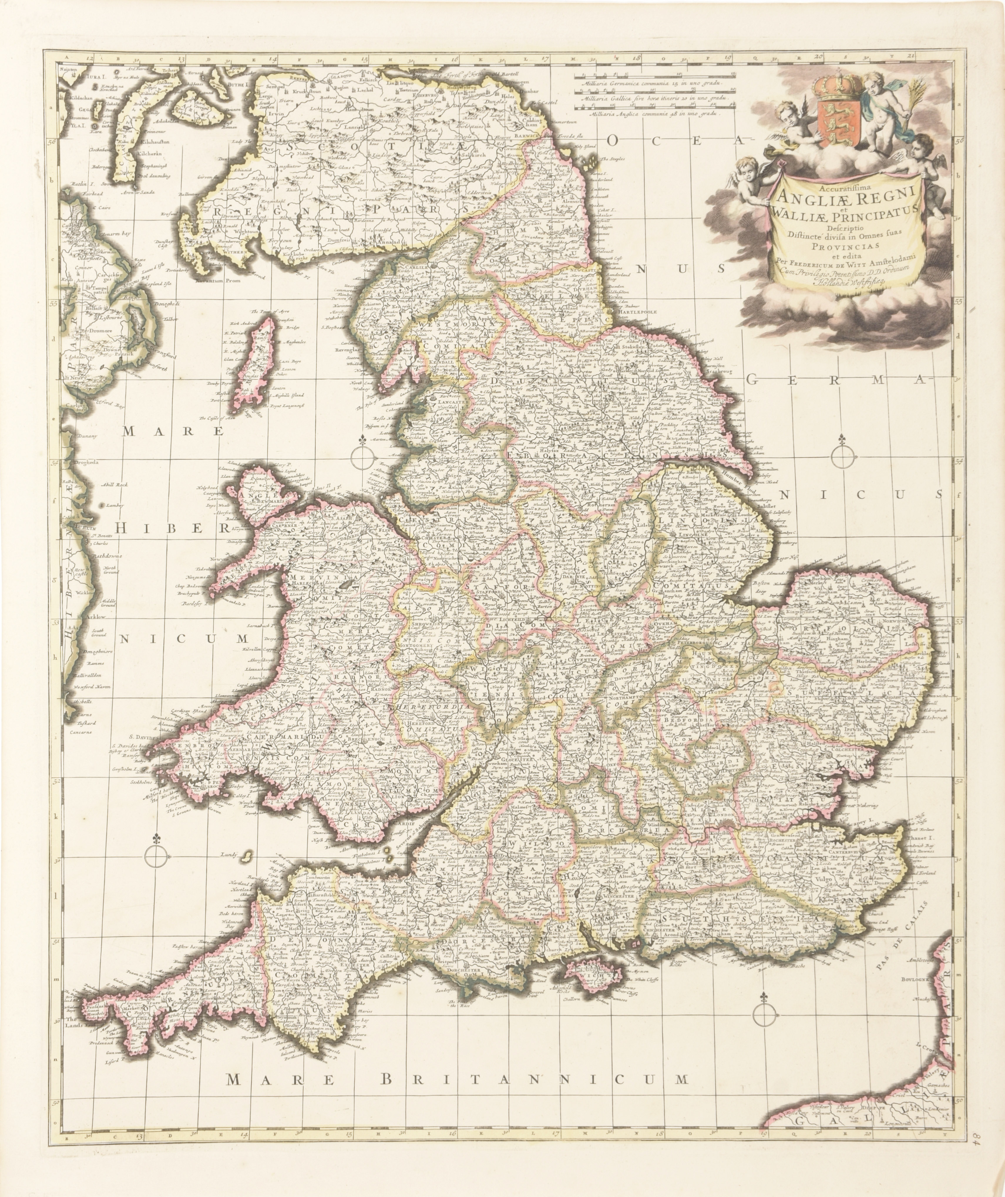
Accuratissima Angliae Regni et Walliae Principatus

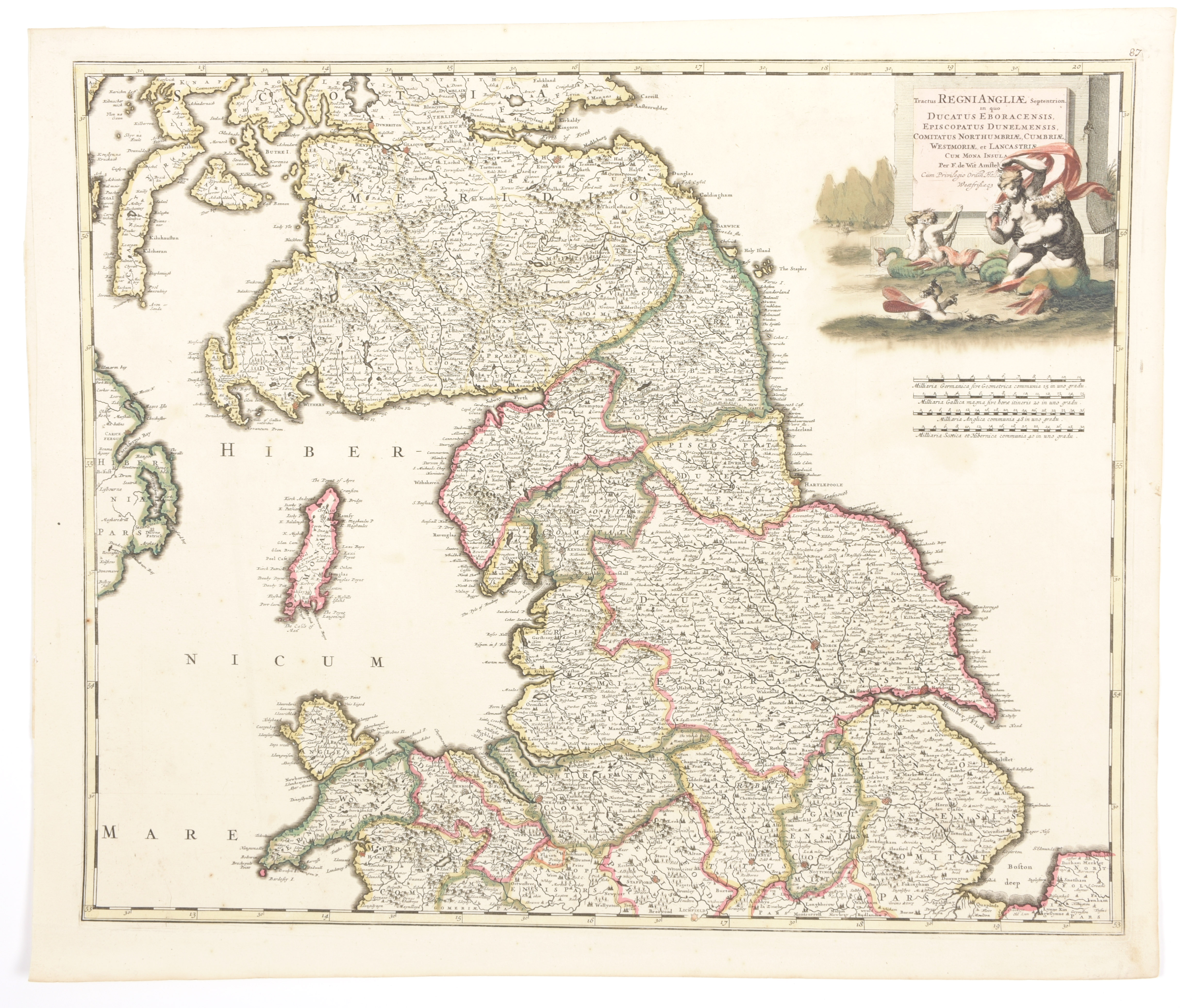
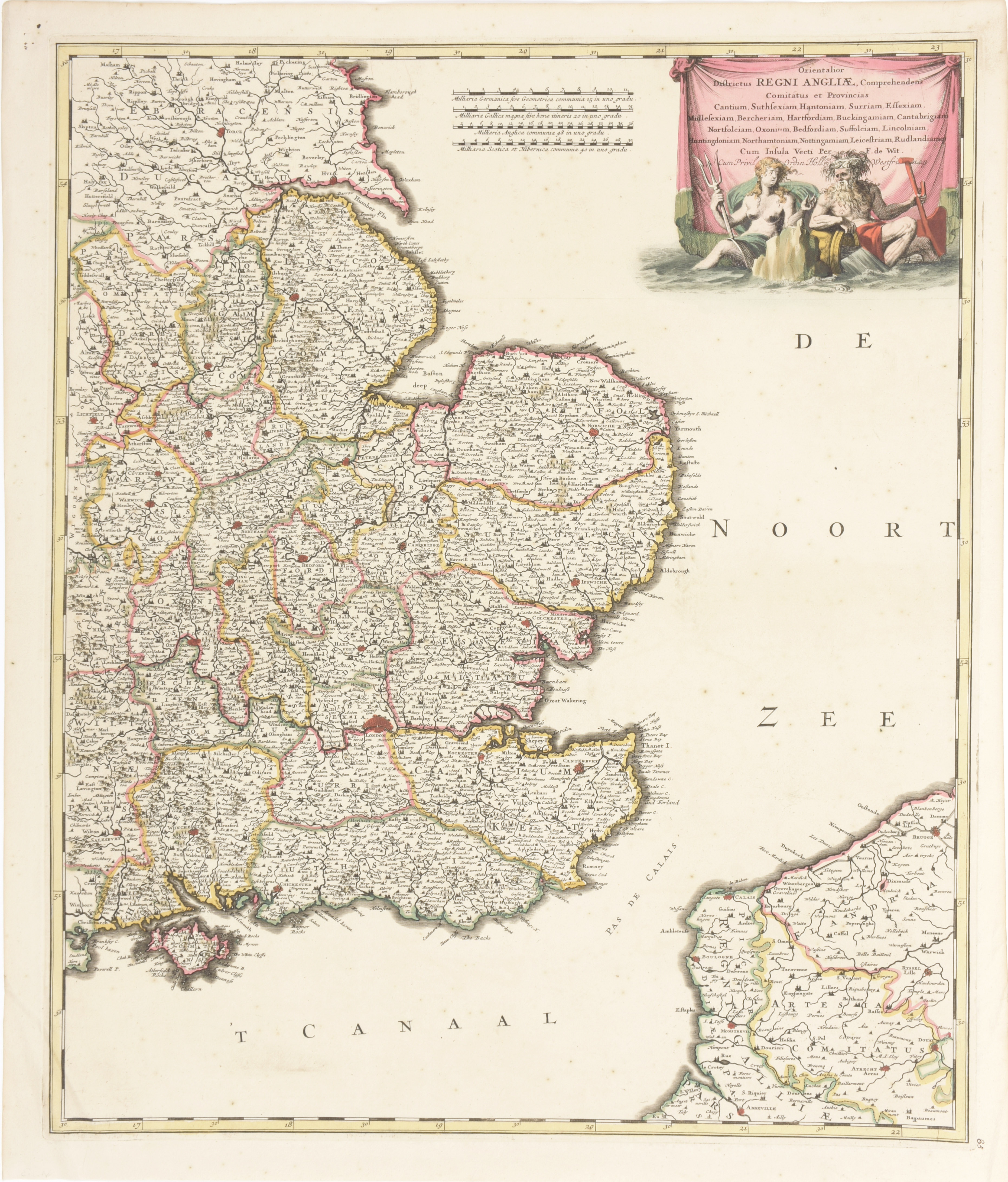
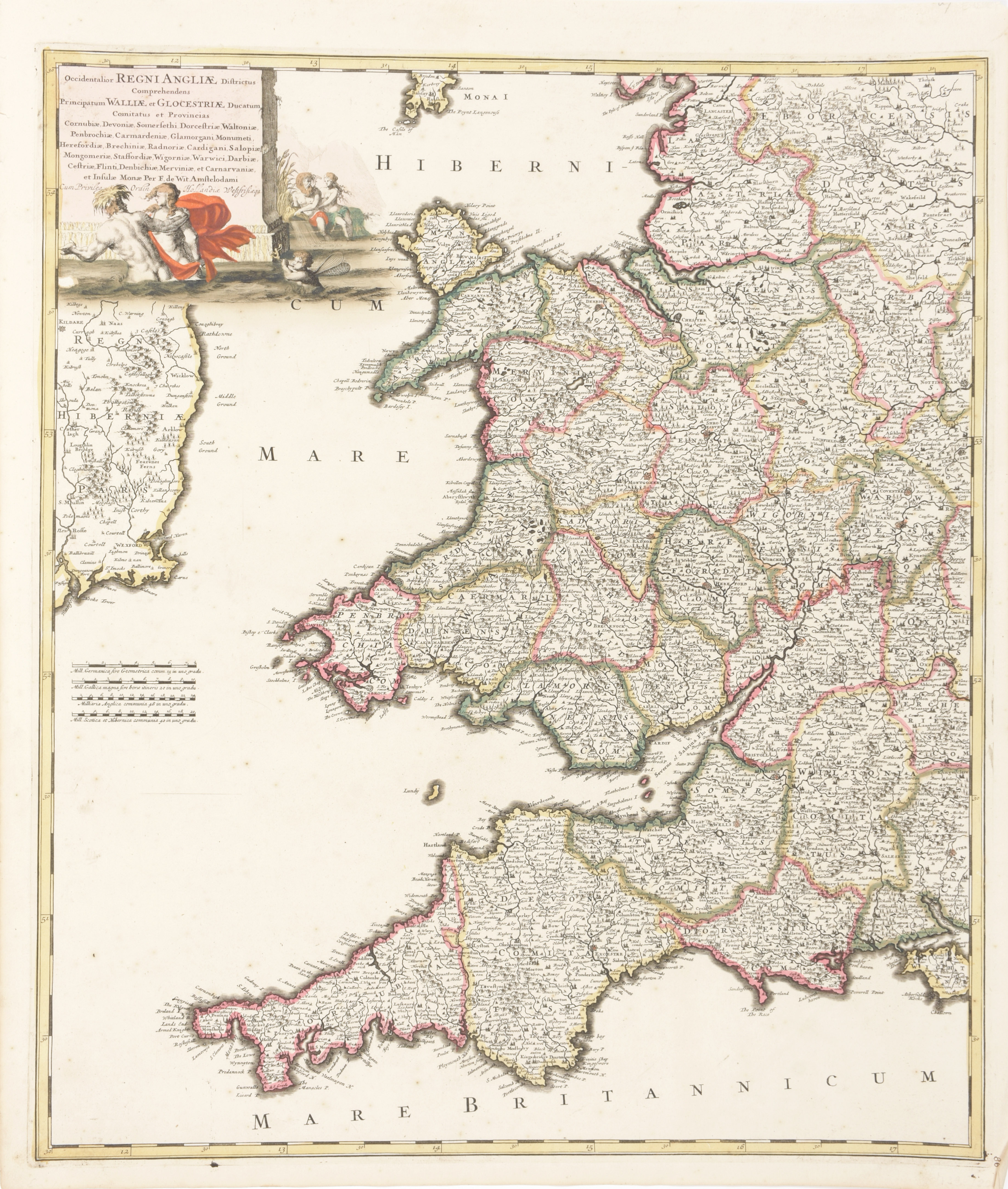
Cont. handcol. chart (58 x 49.5 cm). Amsterdam, De Witt, ca. 1690. We add: 'Orientalior districtus Regni Angliae', cont. handcol. chart (59 x 49.5 cm). Amsterdam, F. De Wit, ca. 1690 + of the same atlas 'Tractus Regni Angliae Septentrion' cont. handcol. (49.5 x 58.5 cm) + 'Occidentalior Regni Angliae districtus comprehendens Principatum Walliae et Glocestriae', cont. handcol. (59 x 50.5 cm) (4)